vessel 538009644 IMO: 9447988, vesseltracker.com
Vessel 538009644 IMO: 9447988,
MMSI: 538009644 callsign: size: x

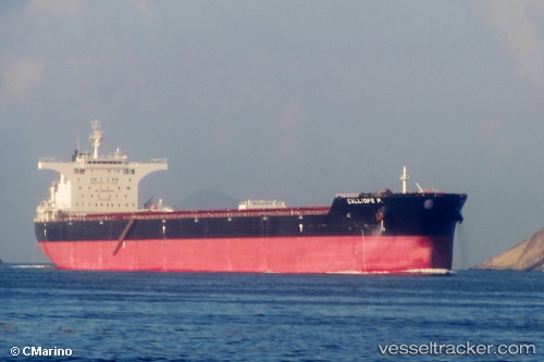
Find the position of the vessel 538009644 on the map. The latter are known coordinates and path.

marine traffic ship tracker show on live map

The current position of vessel 538009644 is 38.5572 lat / 121.049 lng. Updated: 2025-07-07 07:24:21 UTC
Details:


Last coordinates of the vessel:
UTC, 38.4218, 121.595, course: 291, speed: 11.3
UTC, 38.45, 121.49, course: 283, speed: 11.1
UTC, 38.5422, 121.1, course: 291, speed: 10.8
2025-07-07 07:24:21 UTC, 38.5572, 121.049, course: 289, speed: 10.7

Track of the vessel in the last 14 days


Most frequent ports a vessels calls at 538009644 (538009644):

Sambu, traffic: 11
Singapore, traffic: 5
Canakkale, traffic: 2
Lianyungang, traffic: 2
Port Hedland, traffic: 2
Wu-Sung, traffic: 2
Wusong, traffic: 2
Bur Ibrahim, traffic: 2
Port Headland, traffic: 2
Istanbul, traffic: 1
Ras Gharib, traffic: 1
Uskudar, traffic: 1

Link to the map:


Find another ship

538009644 (538009644) last ports (portcalls and passsages)

Singapore | 2023-12-30 00:52:01
Singapore | 2022-11-14 23:56:21
Sambu | 2022-10-04 04:35:02
Ras Gharib | 2022-09-17 01:49:22
Bur Ibrahim | 2022-09-16 16:29:58
Canakkale | 2022-09-13 13:52:42
Istanbul | 2022-08-22 05:33:08
Canakkale | 2022-08-12 10:53:56
Bur Ibrahim | 2022-08-09 04:32:50
Sambu | 2022-06-30 22:21:53
Singapore | 2022-04-15 09:30:44
Wusong | 2022-04-03 13:04:26
Lianyungang | 2022-03-27 09:32:07
Port Headland | 2022-03-07 08:39:14
Sambu | 2021-12-09 09:46:18
Sambu | 2021-12-09 08:57:28
Sambu | 2021-12-09 08:41:37